Bozmaps Verified Insights.
Locating the Unfindable. Verifying the Unknown. Analysing the Unseen.
1️⃣ We Identify
We start with any available details: a company name, facility name, industry, or known references. We then build upon our expertise to understand more on the asset and company / organisation.
2️⃣ We Locate and Verify
Using advanced geospatial intelligence, articles, land planning records, and corporate disclosures, we pinpoint the exact coordinates of a facility. Leveraging satellite imagery, maps, and on-the-ground intelligence, we confirm its existence, status, and ongoing activity.
3️⃣ We Track & Monitor
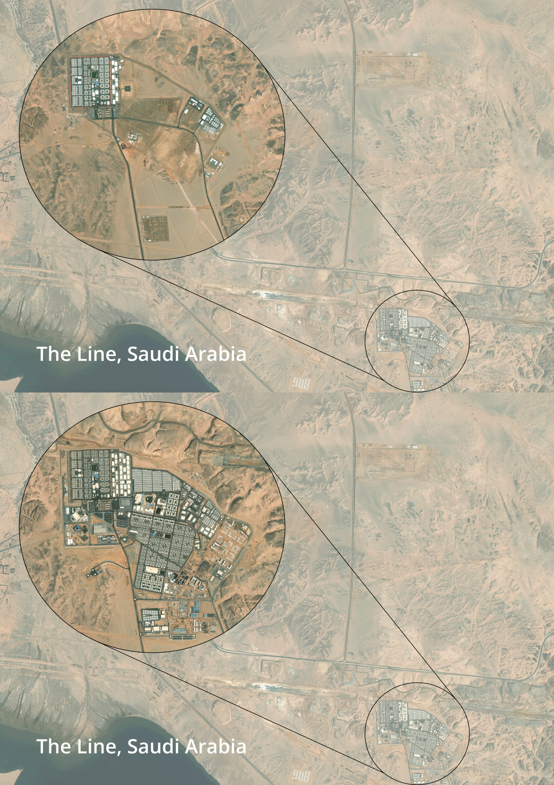
We analyse time-series imagery, detect construction progress, expansion trends, and land use changes. We provide Insights and analysis, providing you with a visual into asset activities, while also being able to quanitfy the impact to supply chains.
High resolution Imagery
Need a closer look? We offer premium, high-resolution satellite imagery upon request.
Gain deeper insights into site details, activity, and infrastructure with higher accuracy and clarity.
Why Bozmaps Verified?
-
Our multi-source approach ensures pin-point precision. We provide a standardised Coordinate location, in any format you require.
-
Detect changes as they happen, utilise our Bozmaps insights approach to visualise company activity, track ground clearance and start to end construction progress.
-
Go beyond location, understand activity, supply chain impact, and industry shifts.
-
Get actionable insights tailored to your needs.

Bozmaps Insights.
Location Intelligence. Quantify Spatial Information.
Location Insights
Quantifying Environmental Impacts.
Unlock deeper value with Bozmaps Insights
Discover how Bozmaps Insights transforms your spatial data into actionable intelligence. Our comprehensive service combines multiple areas of expertise and cutting-edge techniques to deliver clear, detailed insights.
Expert Team:
Specialists in GIS, including urban planning, environmental monitoring, infrastructure management, climate risk assessments, and bespoke asset tracking.
Experts in environmental science, geology, geography, demographics, and data analysis.
🔍 What We Verify
-
What should we know about the services you provide? Better descriptions result in more sales.
-
What should we know about the services you provide? Better descriptions result in more sales.
-
Item description
-
Item description
📊 What You Get
-
What should we know about the services you provide? Better descriptions result in more sales.
-
What should we know about the services you provide? Better descriptions result in more sales.
-
Item description
-
Item description
📡 Who Uses This?
-
What should we know about the services you provide? Better descriptions result in more sales.
-
What should we know about the services you provide? Better descriptions result in more sales.
-
Item description
-
Item description


