 Image 1 of 3
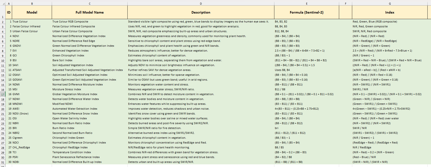 Image 2 of 3
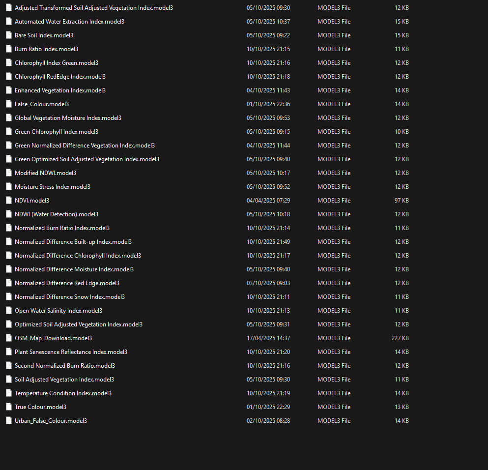 Image 3 of 3
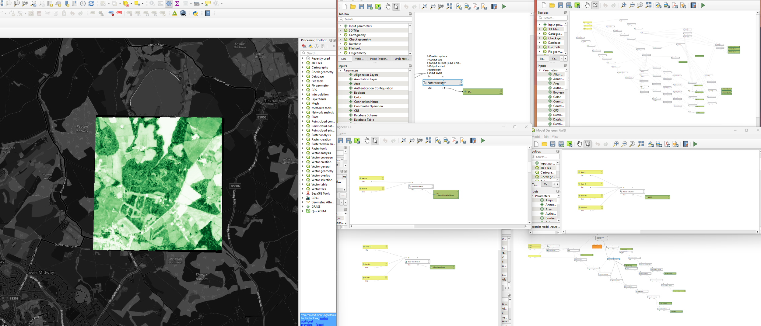
Short, basic QGIS models built using data from the Copernicus Sentinel-2 programme.
These models are intended as starting points, demonstrating how common remote sensing formulas can be implemented within the QGIS Model Builder.
The models represent an initial workflow stage and are designed to be extended. Users are expected to apply their own preprocessing, filtering, and data preparation steps before integrating the models into broader analytical workflows.
Originally developed as part of a larger internal project, this model set has been released publicly as it has remained archived in our database. It is shared to support learning, experimentation, and open geospatial practice.