 Image 1 of 3
 Image 2 of 3
 Image 3 of 3
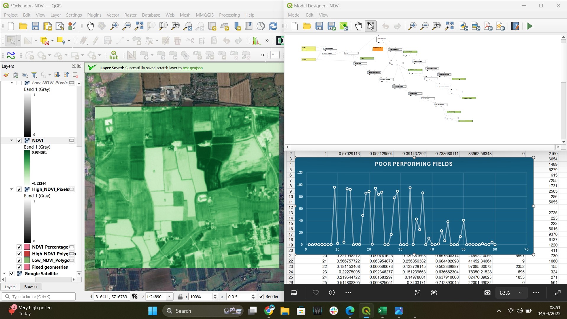
This no-code QGIS model automates NDVI calculation and vegetation health assessment using Sentinel-2 imagery. It clips inputs, calculates NDVI, classifies vegetation condition, and generates parcel-based statistics, ideal for agriculture, land monitoring, and environmental analysis.
This no-code QGIS model automates NDVI calculation and vegetation health assessment using Sentinel-2 imagery. It clips inputs, calculates NDVI, classifies vegetation condition, and generates parcel-based statistics, ideal for agriculture, land monitoring, and environmental analysis.