QGIS Model – NDVI & Change Detection Analysis is an automated workflow built in QGIS for analyzing vegetation change over time using Sentinel-2 satellite imagery. The model calculates NDVI before and after two dates, detects changes, clips to an area of interest, converts rasters to vectors, and outputs zonal statistics, no code. It’s ideal for users working with land use, vegetation monitoring, or satellite imagery workflows.
QGIS Model – NDVI & Change Detection Analysis is an automated workflow built in QGIS for analyzing vegetation change over time using Sentinel-2 satellite imagery. The model calculates NDVI before and after two dates, detects changes, clips to an area of interest, converts rasters to vectors, and outputs zonal statistics, no code. It’s ideal for users working with land use, vegetation monitoring, or satellite imagery workflows.
 Image 1 of 10
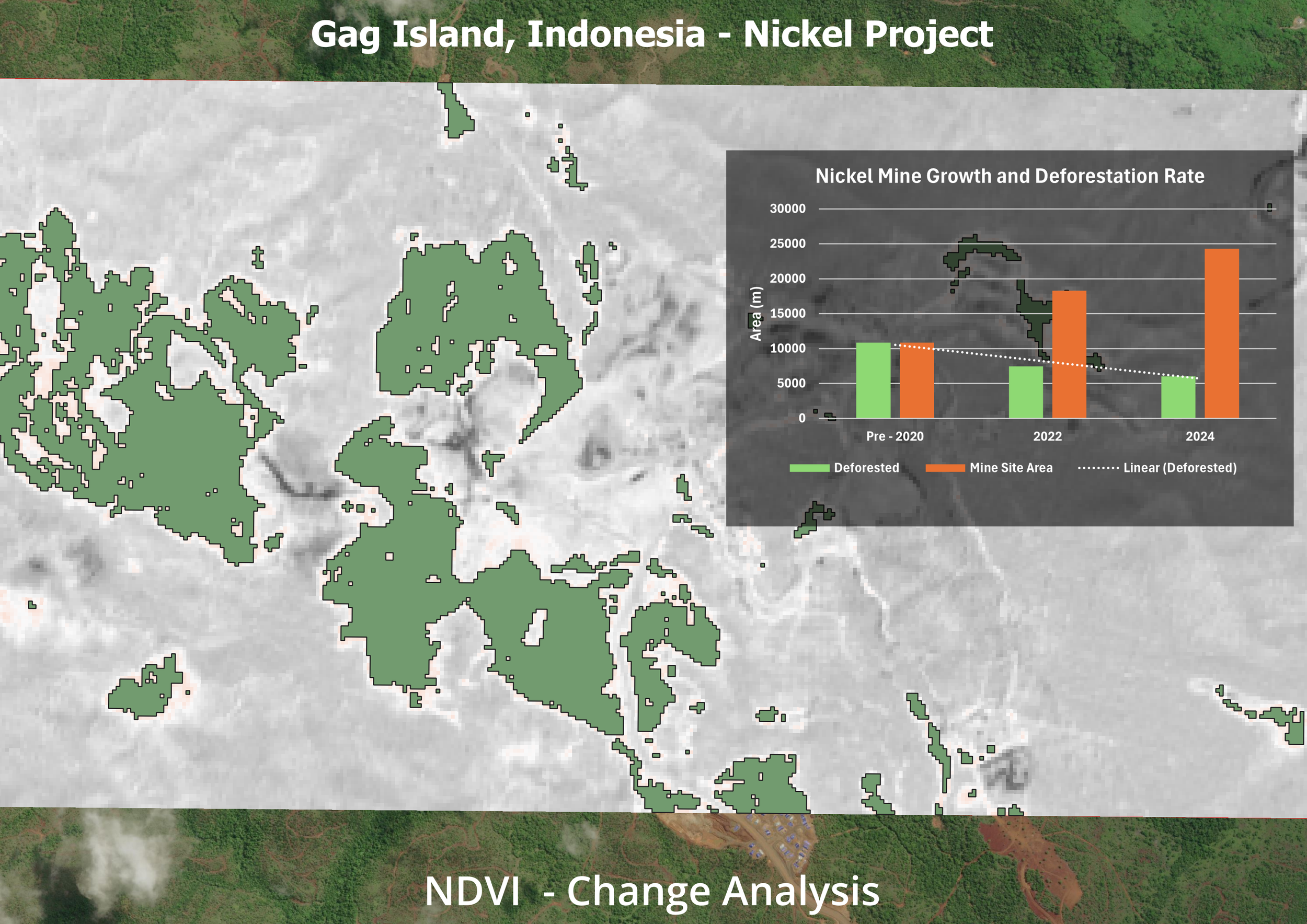 Image 2 of 10
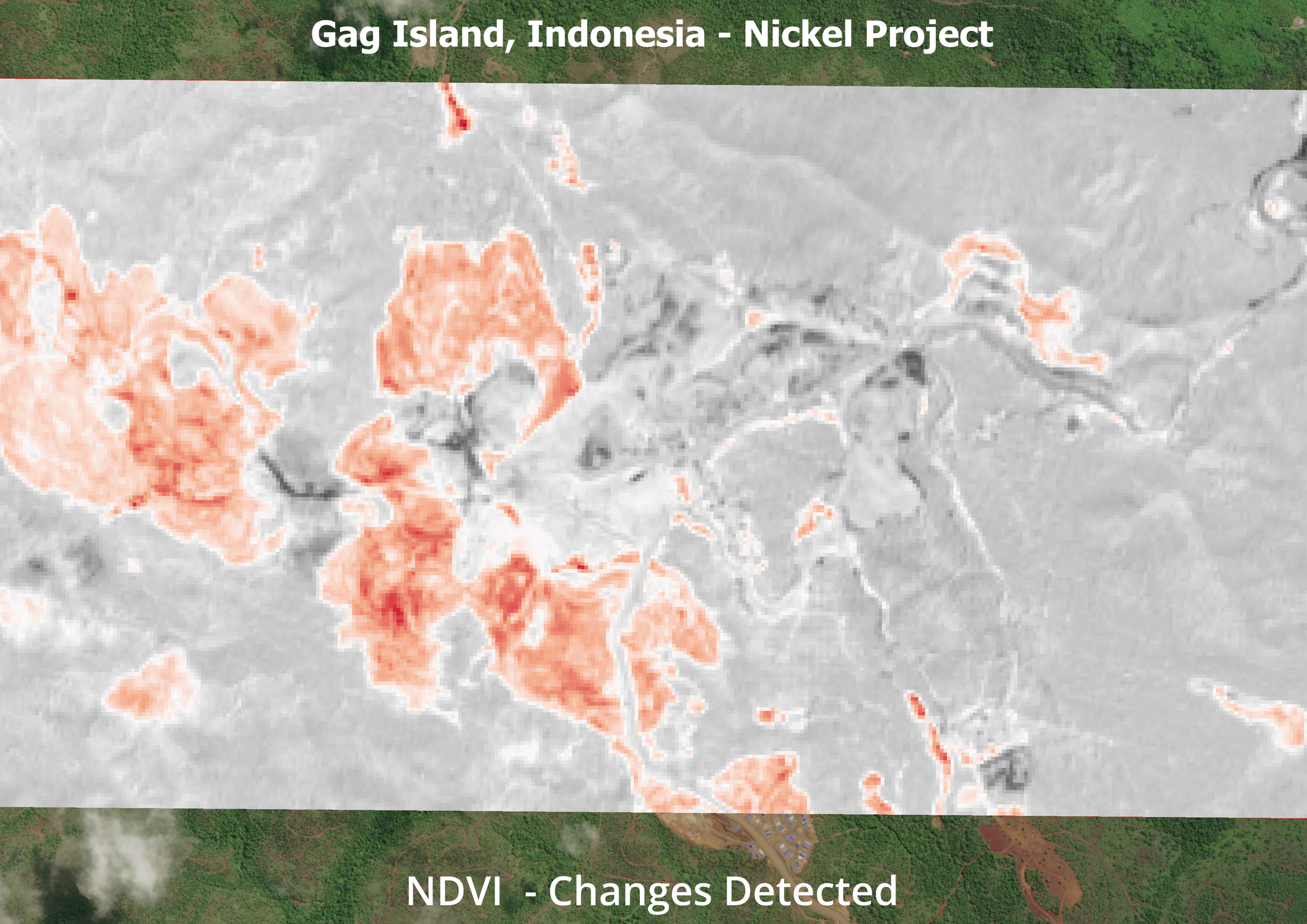 Image 3 of 10
 Image 4 of 10
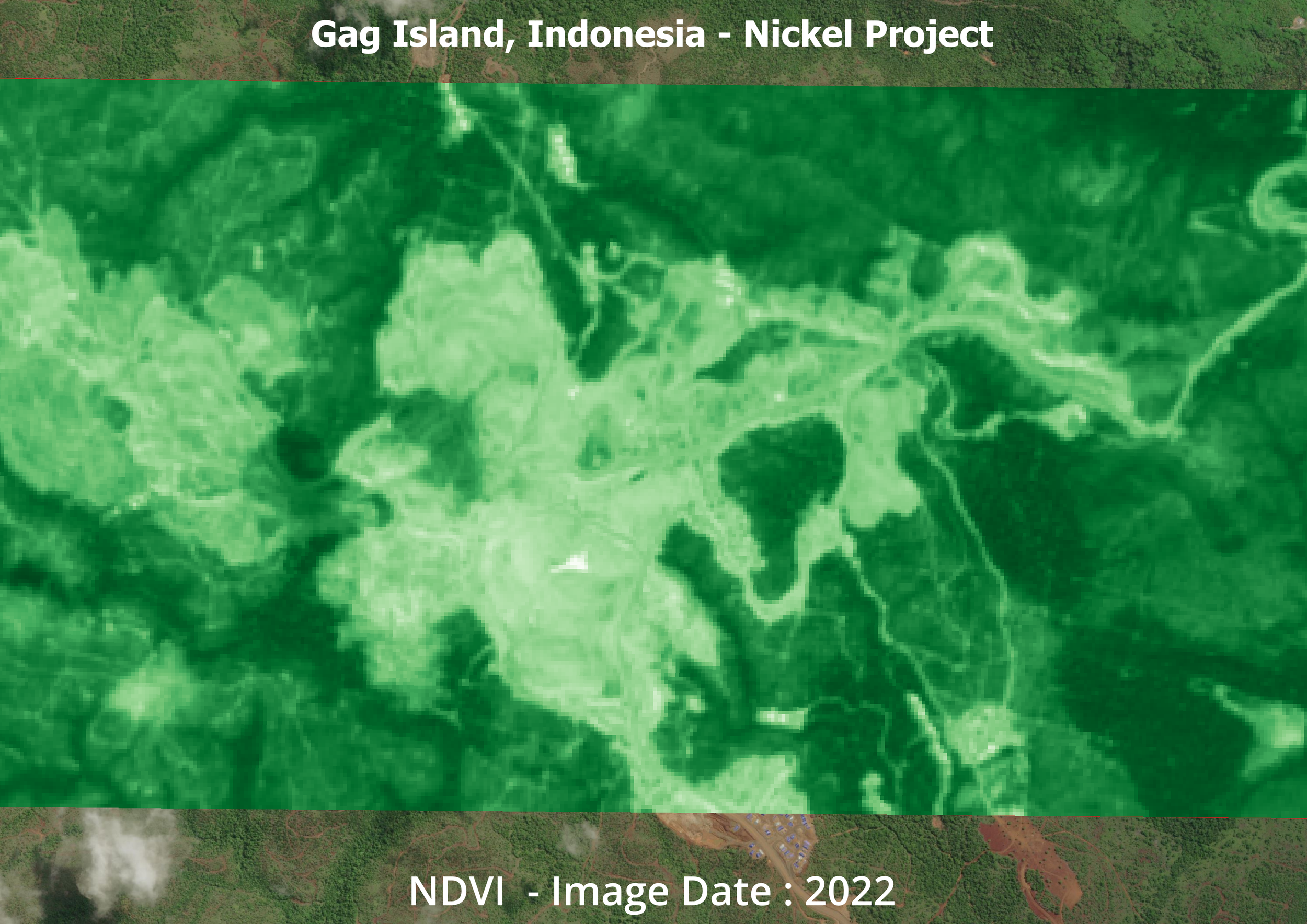 Image 5 of 10
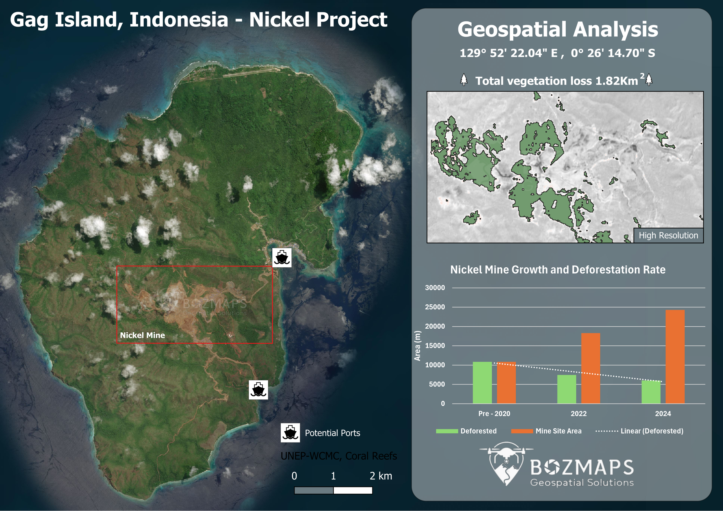 Image 6 of 10
 Image 7 of 10
 Image 8 of 10
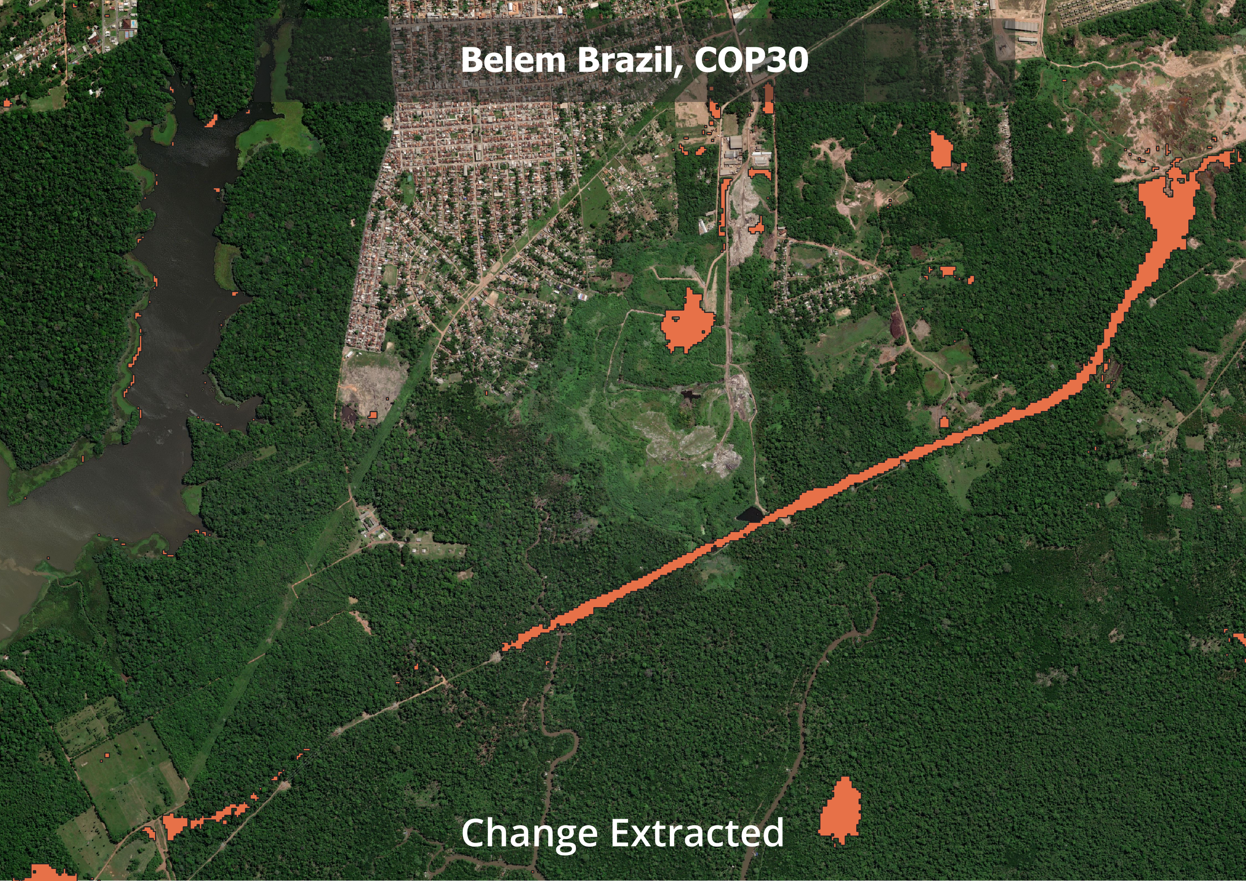 Image 9 of 10
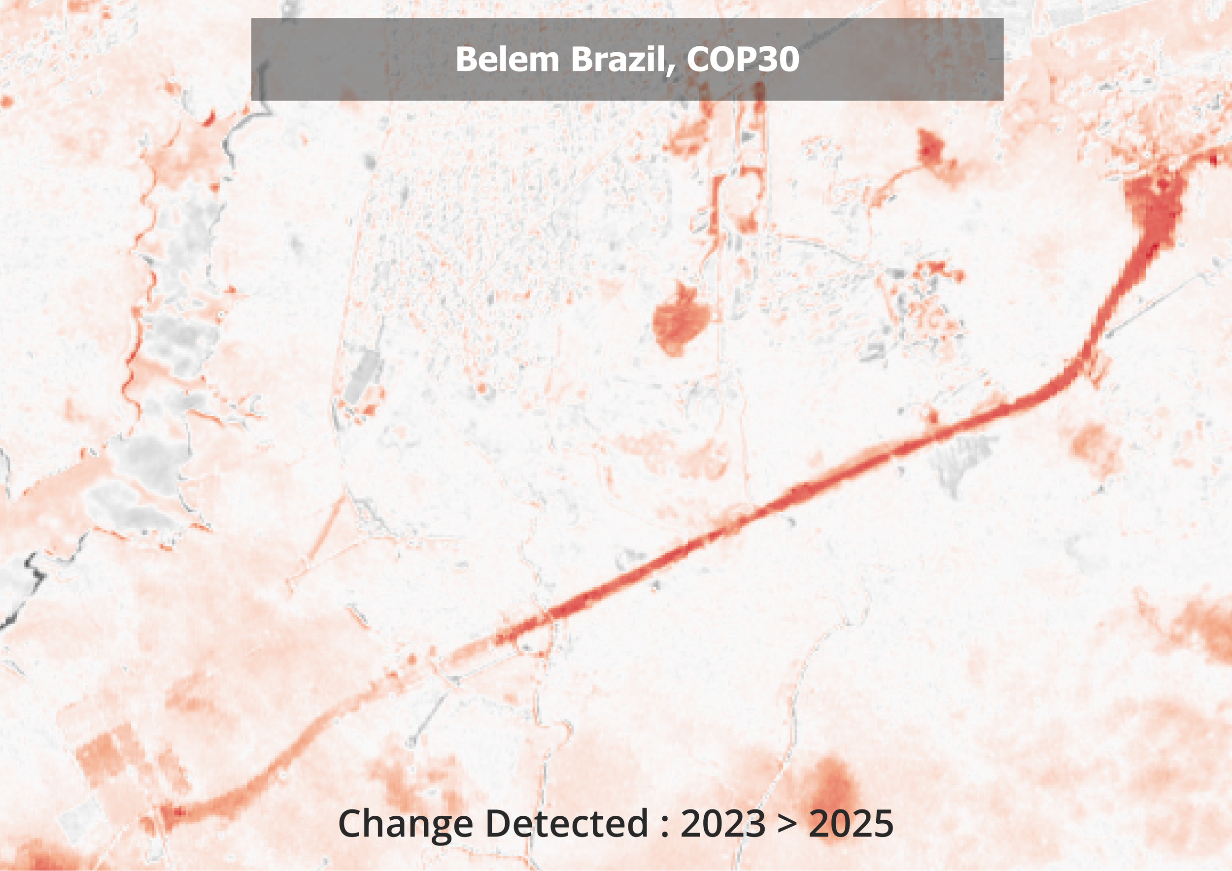 Image 10 of 10